Sunday, March 31, 2013

Day Seven: Red Clay Gap to just before the Cheese Factory site

It was a windy night. I was exhausted and drifting off to sleep while Chuck played music on his little mini-tablet, when all of a sudden we heard a noise. Or, actually, I really didn't hear it; I was half asleep. Chuck heard it, and he thought maybe it was a bear. So, he let out a large bark hoping that the bear would be frightened away. I essentially jumped out of my sleeping bag. It turned out to be branches moving in the wind. Chuck felt a little silly I think, but he did have a great dog impression.

We woke to mist and fog. We packed up our gear and prepared for another walk. I realized that it was Easter Sunday. I hoped we'd reach a spot where I could get reception on my phone so I could call my family.  As we set off for the day, we couldn't see particularly far in front of us (maybe 15 feet). The path was covered in small jagged stone slabs.  The fog made our journey a bit eerie but also quite beautiful. We were in good spirits, strolling contentedly.

When we walk together, Chuck usually has me go first. He doesn't really tell me why, but I doubt it's gentlemanly manners. I think it's because I'm slow, and he can ensure he doesn't push me too hard if I set the pace. Funny though, sometimes I think I work more when I have to lead. I don't want to disappoint or bore or frustrate the person I'm walking with. If I'm in the back and I fall behind... oh well, I expect that. In the front, there are "expectations." Most of the time, I know those expectations are something I make up in my head. Fortunately, I felt fairly confident today, and I was not really worried about whether I was moving quickly enough.

There's something about mist and fog that I just love. It makes me feel a little as though I'm walking through an enchanted forest. Or maybe it reminds me of England. The fog is not as dense as some of the days we spent on the Pennine Way last year. Although I miss England, it's nice that our path wasn't completely covered in mud.

We made our way down Blue Mountain to Unicoi Gap, where we met a trail angel named Crystal. Crystal was handing out bananas, Reese's Peanut Butter Eggs and granola. She'd driven two hours to come and meet hikers and spread some kindness on Easter. Chuck and I got the last of the Reese's (lucky us!), and we hung out with Crystal and the others for a bit. The fog finally lifted as we sat.
    
We decided we should probably start moving again. So, we hoisted our packs and started to climb Rocky Mountain.  As I walked, I mused about how funny it was to find a "Rocky Mountain" outside of "the" Rocky Mountains.  The climb was relatively steep, 13% grade, but there were lots of things to see along the way - twisty tree-like vines, far off mountains, and our first flowers!


I was excited to see the little tiny flowers starting to come out.  I realized that I was getting an opportunity to really watch the season change from winter to spring - to see the small changes that happen from day to day or from hour to hour.  I normally am so busy working, living, running around that I don't always notice when things start to sprout and bloom.  I think it's good for me to have this time with nothing to consider but the world around me.

We reached Indian Grave Gap and saw a couple of groups of college-aged hikers had stopped to smoke some pot.  Chuck and I decided we'd keep moving... So much for looking around for the Indian graves! We started up Tray Mountain.  
I love this picture!
But... not as much as I love this one!
Our guidebook said we were approaching an old cheese factory site. It seemed an odd place for a factory. Maybe that's why it was an abandoned site.  We would never actually see it.  At this point in the day, Mother Nature decided She had been kind long enough. We'd heard all day about storms, and I can't really explain why we didn't move any faster earlier in the day. We were headed down the side trail towards the factory site and a water source when it started to pour! 

In England, we sometimes walked all day in the rain. You just had to deal with it there. But, Chuck was not very excited about spending time in this rain. We both got stressed out. We back tracked to a flat spot and started trying to set up the tent, in the rain.  It was just a bad decision all around. We were soaked, and now the tent was soaked too. Tempers flared. It wasn't pretty.

Eventually the rain stopped (and it was still light out). We moved the tent around and attempted to dry as much as we could. It was an early end to the day, and we were both frustrated with our earlier relaxed attitude. But, alas, we lacked the ability to go back in time. So, we lit a small fire and made some dinner. Slowly the stress level abated. 

Saturday, March 30, 2013

Day Six: Just Past Wolf Laurel Top to Red Clay Gap

We were the first ones up again. We wanted to get an early start as there were more warnings of rain or thunderstorms coming. It was overcast and a little cold. Our first climb was called Cowrock Mountain. I wondered briefly why they had named the mountain so strangely - I saw no rocks that looked like cows or like cows would have anything to do with them.

No cows in sight on Cowrock
After the seemingly misnamed Cowrock Mountain, I could only hope that the next peak (Wildcat Mountain) would also fail to live up to its name. The climb was brutal, an 18% grade. As usual, I quickly fell behind Chuck and was getting passed by everyone we'd camped with the night before. But, I was determined not to let this bother me today. "I think I can, I think I can..."

When I reached the top, Chuck was patiently waiting for me. He was talking with a young man who'd passed me not long before. Wombat had finished high school in January (he was home-schooled) and now he was following a dream to hike the Appalachian Trail before starting college in the fall. He had so much energy and was going fast (he'd started only a couple of days before). He seemed like a nice kid, one his parents should be very proud of.

Amazing views!
We seemed to be making good time today, despite the hard climb, and so we decided to take a little mini-siesta once we passed Hogpen Gap. We found a nice spot and quickly took the weight off our backs (and feet). Chuck decided lunch would be cream cheese and pink salmon. Not my idea of "yum" but he seemed to enjoy it.
Tasty?
I had a less interesting lunch of bars and a little Babybel cheese. Mostly I just wanted to enjoy the feel of the sun (which had finally decided to make an appearance) on my face as I lay on my back in a pile of leaves. It was glorious!

All along our walk, we've seen interestingly shaped trees and vines - funny lumps and bumps,strange twisty vines reaching up to very high branches. This section of the trail seemed to have a lot of unique sights. How do they grow that way? Is it some kind of disease or just a weird mutation?
The bumpiest tree I've seen so far
 

The trail seemed to be easing up on us, and we meandered our way down to the Low Gap Shelter around 3:30 in the afternoon. There were already quite a few people in the shelter and more camping in the area. We weren't really ready to call it a day, but we thought a break could be a good idea. So we decided we'd stock up on water and have an early dinner before we put in another couple of hours. We found a spot near the source of a stream that ran down to the shelter and spread out for an extended break.
On our way down to the shelter we had encountered a man in his early 60s who was really struggling and clearly suffering. He had been wanting to do the hike for a long time, but he'd also had a couple of bypass surgeries in the past couple of years. He just didn't seem to be up to the challenges the trail was throwing him. It had taken away his appetite, and he looked exhausted. While we were taking our break, he decided he was done and made arrangements to be picked up in the next town in a couple of days. He was so defeated. Chuck had tried to encourage him to take a day off to see how he felt, but you could tell the man was just done. I felt sad for him and grateful that I wasn't being forced off the trail by my own body. The more time I spend on this trail, the more I don't want to leave it in a few days.

As we finished our break, the hordes started to descend on Low Gap Shelter. Every few minutes more and more hikers were arriving. There were already at least 30 people and more were reportedly on the way. Chuck and I decided it was probably time for us to escape!

Once again, the trail was literally peppered with springs and little waterfalls. Chuck and I both love nature's "water features" and these were all worthy of adoration. When we reached a waterfall with a little pool at the base, we decided it was time to be nice to our feet for a change. We sat by the pool and soaked our feet. The water was very, very chilly, but it felt wonderful. We kept our feet submerged as long as we could stand.

It would have been great to camp right there, but there was no spot. So, on we went. The trail was lovely - we were surrounded by trees with leaves. I couldn't ask for more (except maybe someone to massage my feet).

We finally settled for the night at Red Clay Gap. We'd walked 12.9 miles, our biggest day so far. Although most of the day had been warm and sunny, we knew rain was coming. We found a spot we hoped would keep us sheltered from the brunt of the storm and settled in for the night.

Friday, March 29, 2013

Day Five: Henry Gap to just past Wolf Laurel Top

It was another early start to the day. Chuck had tried to pick our campsite so that we might (okay, correction - HE might) see the sunrise. Although he woke up early, the mountains that were surrounding us  effectively blocked the sunrise. Despite his disappointment, Chuck was nice enough to let me sleep a little bit more because today we needed to go over the ominous-sounding Blood Mountain (which would be my highest elevation point on my hike). No one is sure how the mountain got its name.  Some believe there was a battle on the mountain between the Cherokee and Creek Indians, and yet others think the name is based on the lichen and Catawba that grow near the top of the mountain. I have no idea how lichen or Catawba relate to blood....actually, I don't really know what Catawba is. Regardless of how it got its name, our guidebook made it look like a steep climb.  

The prospect of a difficult climb tends to make me nervous about my capabilities as a hiker. I know I am slow, and Chuck tells me it's fine because the longer he spends on the trail, the better. But, I worry that there may be such a thing as "too slow" and that I will prove it. I remind myself that I just have to keep putting one foot in front of the other, and I will get to the top (eventually). 

Although the first three miles were a gradual climb, all too soon we started to climb Blood Mountain (an average 13% grade. Yikes!). With Chuck far ahead of me, I decided I needed to pull out my tried-and-true counting technique. My brain likes to count - it's a distraction technique. I try to guess how high I can count before I reach the top, and I tell myself "you only have to keep going until you reach <insert estimated count>." The funny thing is I almost never pick the right target and yet as long as I just set a new revised goal, I can keep going.

About half way up, I encountered another hiker who had been taking a break. He looked about ready to get started again, and so I suggested that perhaps he should go ahead of me so he wouldn't have to pass me later. To my surprise, he told me he thought he was likely slower than I was. A few minutes proved him right. Hurrah! I graduated from snail to turtle! Finally, I reached the top and reunited with Chuck, who had been patiently waiting. We spent a few minutes admiring the stone shelter there. It looked like a house!

The views from the mountain top were amazing, even though it was a cloudy day.
A little below the top
As we started down, we were walking across rocks, kind of slippery rocks (no dirt path here). My hiking boots had proven less than reliable on stone on the Pennine Way, and the grade of the descent made me start worrying that my knee might start hurting again. So, it was back to turtle pace for me. But here I kept repeating "step lightly...walk like a cat..." (both were pieces of advice Chuck gave me in England). It seemed to work, and again I was not the last one down the hill! Banner day for Ruth! 

At the bottom of Blood Mountain is Neel Gap, our first re-supply. There were lots of thru-hikers hanging out at the picnic tables outside the store (the Walasi-Yi Interpretive Center). A few were leaving the trail to head back to school after Spring Break. 

We put down the packs, enjoyed talking with others, and just relaxed.  Eventually, we took turns doing our shopping. I was still not completely sure how to judge how much food I would need for the next several days. I bought a few meals to cook, tried to figure out how many snacks and bars I'd need, and picked a few treats. Hopefully I won't starve before Hiawassee!

There was an option to stay at Neel Gap in a hostel, but we'd only walked about six miles so far. So, we decided to hoist our packs and start off again. Our first steps back on the Appalachian Trail were actually through the Walasi-Yi Center... But, after that, we were immediately back to climbing again. As I had eaten a decent lunch and had a little sugar, I was ready to tackle the hills again. The trail was quiet, most people stopping at Neel Gap, and so we had time to pay attention to the little things - specifically, the little red bugs we'd been seeing.
Some kind of mite
We ended up going about four miles past Neel Gap, stopping when we ran into a fellow hiker, Chris, who we had camped with at Justus Creek. We were soon joined by Mitch, his adorable dog (Bella), and Caboose.  With the potential for rain, we settled into our tents early and called it a night.

Thursday, March 28, 2013

Day Four: Justus Creek to Henry Gap

There's nothing quite like a good night's sleep, unless perhaps it is having as much water as you need! We got off to our earliest start yet (with completely full water bottles of course). We were the first out of the campsite, and this meant we had quite a bit of time to ourselves at the start. We listened to the birds and admired the sun as we walked through the trees. 
Crossing Blackwell Creek
It was a lovely day for a walk - starting to get warmer, nice and sunny. The path meandered its way up to Ramrock Mountain. From the top, we could see for miles, probably because there were no leaves on the trees - one benefit of starting the hike in March.
Ramrock Mountain
There were three hawks soaring around the top of the mountain. They didn't seem to be hunting, just enjoying being able to float on the wind, rising and dipping with the air currents. Hawks are beautiful creatures. I had seen a documentary about how falcons and hawks can ride through the air with barely a beat of their wings. I watched them with envy. What would it be like to soar through the air like that?

My grandfather loved hawks. Every time I was in a car with him, he always saw at least one. He passed away a couple of years ago after a long life filled with adventures and music and traveling. I miss him. As I watched the hawks, I wondered if maybe they were a sign from Grandpa, that he was watching me on this hike with a smile...

Pressing on, Chuck and I marveled at the number of springs that were right near the trail. We wondered why no one marketed Georgia spring water. As we walked along, we stopped at the springs and filled our bottles, able to drink without filters because we were so frequently passing the actual spring sources. After our lack of water yesterday, I loved every sip of water I took.
One of the many springs along the trail
We passed through Woody Gap. This was our last opportunity to head into the town of Suches to resupply if needed. The AT Guide indicated that there were a few stores there, but conversation with other hikers led us to believe that Suches did not have much-es. So, we decided we could make our food last and keep going.
Woody Gap
We headed up Big Cedar Mountain. We started to see lots of other hikers. Some new, most people we'd encountered already. At the top of Big Cedar Mountain, there was a large rock edge with impressive views. People were relaxing on the warm stone, taking their shoes off, basking in the sun. 


We relaxed, ate a bit, and enjoyed the views. A number of the hikers were doing some foot repair - blisters.  I had noticed a little pain on one toe, so I figured I'd better check and took off my boots. Sure enough, I was starting a blister on one toe. Fortunately, I had prepared for this and quickly wrapped my little toe up.

The next couple of hours were spent coming down from Big Cedar Mountain towards Henry Gap. Just past Henry Gap is Jarrard Gap, where hard-shell, bear-resistant canisters are required in order to camp for the five miles past it. Everyone we had seen was planning to camp at Lance Creek (2 miles before bear country), and we were wondering if our early start would mean we'd get there before too many people arrived. Well, there must have been a race to Lance Creek because the campsite had 10 or 12 structured tent sites and they were already full. People were camping all over the surrounding area.

There was no real decision to make - on we went. As we walked, we met up with Alex, a young man from the north east. We had first seen Alex on day two, and he seemed like a nice guy. Alex had the same backpack as we did, so he must be smart. Alex and Chuck found a campsite at the top of Henry Gap. We each set up our tents and then hung out for a bit while we ate. Chuck and I finished our evening with a game of Scrabble. 

Wednesday, March 27, 2013

Day Three: Just past Hightower Gap to Justus Creek

So far, Chuck and I are two for two in terms of having one day on our hikes where we screw up logistically and have to pay for it. Last night was the screw up and today we paid. Although we passed two water sources (one was a stream we had to actually cross) in our last mile and a half, we didn't fill all our water bottles. I can only say that water had been so plentiful all day yesterday, we started to just assume water sources would be abundant all along the trail. Unfortunately for us, our last water source for the next five miles was one mile behind us on the trail. For those who read my Pennine blog, you may remember that we didn't get water at the start of day one either.

Fear not, dear reader, obviously we survive!

When we started the day, we weren't too worried about the water situation. From our camping spot, we were watching hikers pass us on the trail without even noticing we were there. Their heads were down, and they were focused on the hike. We started our day's walk in great moods. It was a little chilly, or at least we thought it was, although the sun was out. I kept most of my layers from yesterday on, not trusting that the sun signaled warmer temperatures.  It was a beautiful start to the day.

One mile in, however, we started to climb Sassafras Mountain. And here is where I seem to have lost my brains. It was a steep climb, 12% grade on average, over a mile, and the sun was shining. I am a slow climber on the best of days. Well... I can climb at a decent pace for a short period of time, but on extended climbs, I'm slow. I was already out of water, the sun was shining down and yet it never once occurred to me to take off some of my many layers. So I was hot, tired, and thirsty instead of just tired and thirsty.

When we climb, Chuck usually goes ahead of me and waits at the top. He was sticking with me today though, which I appreciated, going ahead a bit and then waiting every few hundred yards. I was getting passed by lots of other hikers. I started to get frustrated. All of my insecurities about my abilities, my worries about making Chuck's hike miserable with my slowness (both of which were challenges during the start of my Pennine hike), they all came rushing back. I started wondering if I could call Jill and have her come pick me up. And, I got emotional, teary even.

Chuck was struggling too. The lack of water was giving him a migraine, and he needed to keep moving to try to get to some water. He encouraged me to just keep putting one foot in front of the other. To try to thwart the headache by finding water, he had to move on at a faster pace than I could manage. I watched him go and felt a little sorry for myself.

I lumbered on, and finally, finally I reached the top. Chuck was nowhere in sight. There was nothing to do but keep going. As I headed down toward Cooper Gap, I caught sight of Chuck at last, almost at the bottom. It gave me a little boost of encouragement. He wasn't THAT far ahead of me.

As I approached the bottom of the hill, I saw that a number of hikers had stopped in Cooper Gap and there was a truck there as well. It was my first experience of trail magic. Captain Guts, a man from Peoria who had attempted to hike the AT the past two years, had decided that this year he would play trail angel instead. He remember this section of the trail as one without much water, and so he brought a cooler full sodas, hot dogs and a little grill, and big jugs of water. I don't know that a cold root beer has ever tasted so wonderful!

We relaxed in the sunshine, refilled our water bottles, drank some soda... life was good again! Reinvigorated, we set off again. Justus Mountain was almost as steep as Sassafras Mountain, but the climb was only half a mile, and with a jolt of sugar from the soda, I was not going to be conquered by it. And I wasn't.

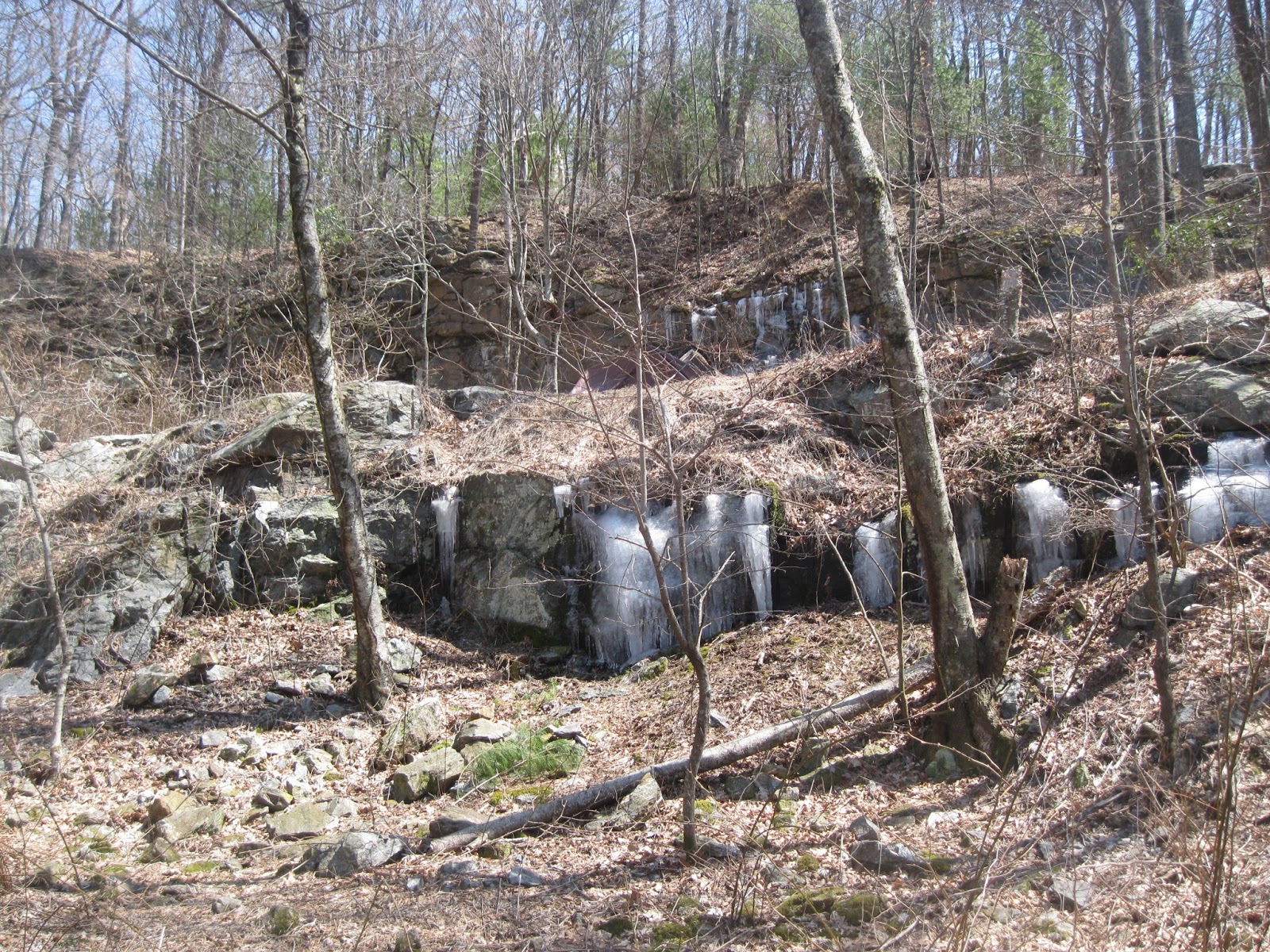
The descent was long and lovely. We were finally enjoying the day, although there was still plenty of ice around.
My only picture of the day
When we reached Justus Creek at the bottom, we made sure we filled up all four bottles and both of our camelbacks. There was a campsite right above the creek, and so even though we had only done five miles, we decided to call it quits.

All in all, it was a hard day. Chuck's migraine was still plaguing him, and I was starting to get hints of a migraine as well. But, the people at the campsite were all very nice, and Chuck eventually felt well enough to do some socializing. I stayed in the tent, not quite past my headache. We had an early night with hopes that tomorrow would be better.

Tuesday, March 26, 2013

Day Two: Springer Mountain to just past Hightower Gap

Make no mistake, it was a cold night. And there was a lot of snoring! All night long. For the most part, even though I didn't sleep a lot, I was warm during the night. But there was a lot of noise to deal with - wind noise, people noise, noise - and I was awake frequently and for long stretches of time. I was hoping we weren't planning to spend many nights in shelters. Sleeping in groups is not really my thing. Fortunately, I'm pretty sure it's not Chuck's thing either...

One of the late arrivals last night was a young woman from New Hampshire. She didn't bring a tent, she brought a hammock. Full of exuberance for her upcoming adventure, she had set it up between two trees. Many of the people in the shelter tried to convince her to come in and share a tent with someone if it got too cold, but I guess she didn't feel comfortable with that idea. She had a cold and unpleasant night. As soon as she could, she called for a shuttle to take her up the trail to Neel Gap. Three of the others who had spent the night in the shelter joined her. A little scary to think that only 0.2 miles into the Appalachian Trail and four people were bailing. What was to come?

Chuck and I decided to stay in our tent while all the other shelter occupants packed up and left. Well, I stayed in the tent. Chuck watched the activity for a bit. Finally, he got cold and came back into the shelter.  We both fell asleep once all the people were gone. It was blissful. When I awoke, it was noon. Yikes! Chuck was inclined to spend the day in the shelter due to the cold. But, I was restless. We were rested, we had lots of clothes, we should be walking! It didn't take much for Chuck to come around to my point of view.

It was definitely a chilly start. More snow had fallen overnight. I put on most of my clothes - two fleece tops, my down jacket, tights, wind pants, hats, gloves... you name it, I was wearing it. We set off, expecting the worst. Fortunately, the exertion warmed us up quickly. Soon, we were back to loving the walking and marveling at our surroundings.
Icy!!!

Chuck suggested we plan to simply make the next shelter 2.6 miles away. That seemed like an easy -to-accomplish goal, and I personally hoped we would make it a bit farther. We passed through some sections of the trail that seemed almost like a jungle. We weren't sure what the bushes were, but the feel was distinctly reminiscent of Hawaii to us both (granted though a Hawaii with a dusting of snow). Maybe they are rhododendrons - although they look more like trees than bushes.
We reached the Stover Creek Shelter fairly early in the day. There were already a number of people who had decided to stop for the day. They had built a fire, and we enjoyed warming ourselves for a bit. The shelter looked like it was going to be crowded, and we both agreed we still had lots of energy. So, we had a bite of lunch and then put our packs back on and headed off.

We were in good spirits, and we seemed to be making good time despite our late start. As we moved along, the snow was disappearing. Hooray! We stopped to admire nature's handiwork all along the trail:
Fungi growth on trees
 
The walk was fairly easy - gentle descents AND gentle climbs. Eventually we reached the next shelter, Hawk Mountain Shelter - 5.3 miles beyond Stover Creek. We definitely did have energy!! The shelter looked pretty crowded, and so we decided to keep moving. We kept going for another mile and a half, making today's mileage 9.4! I was impressed that despite our very late start, we'd managed to get our planned mileage completed.

We found a clear, if slightly slanted, spot to camp.  Chuck piled leaves all over the ground to help make the ground a little more level. I was hoping it would make the ground a little softer, as I tend to wake up with sore hip joints from sleeping on my side. We finished right as it started to get too dark and settled into the tent for a well-earned rest. 

Monday, March 25, 2013

Day One: Amicalola Falls State Park to Springer Mountain

The start of the Appalachian Trail is on top of a mountain (Springer Mountain) in the middle of the Chattahoochee National Forest. It is 8.8 miles from the Visitor Center to Springer Mountain, and the path to it is known to AT hikers as "the Approach Trail." Many AT hikers choose to drive via Forest Service roads to a drop off point approximately one mile from Springer Mountain and then hike back to the start. Chuck and I were a little perplexed by that as we figured an additional nine-ish miles wasn't something worth skipping, especially when the miles have waterfalls attached to them!

As anticipated, today is cold and grey. Jill took us out for breakfast on our way to Amicalola State Park - our last warm breakfast for a while. While we ate, we noticed flurries of snow starting to fall from the sky. Great.... But there's no turning back now. It's time to attack the trail!
Springer Mountain here we come!
We signed in at the visitor center, put on our warmest clothes, adjusted our packs and were ready to go.  The walk leading up to the Falls was beautiful despite the barrenness of many trees, and although the day was overcast, we were in great moods.  Why would anyone skip such a pretty walk?
We could hear the roar of the Falls ahead of us, and through the trees we started to catch glimpses of what is the highest waterfall in Georgia (729 feet). It was breathtaking! To reach the top of the Falls, you must climb 604 steps, and trust me, they were steep. As we climbed, Chuck and I wondered how they were built: the hill the stairs scaled was so steep, we imagined builders dangling from ropes as they built a really sturdy and strong set of stairs.
 
Many stairs yet to go
Finally we reached the top! Chuck noticed that the snow flurries were flying in an upward direction above the waterfall. It was a strange and almost eerie phenomenon. Some of the snow must have been falling the right direction though because the bridge over the top was just starting to get a dusting of snow on it. I hoped that was all we'd see today, just a dusting.
We left civilization behind us and headed off into the wilderness.  The next several miles were a slow and steady climb up over various mountains and hills - Frosty Mountain, Woody Knob - with only a few short descents into Nimblewill Gap and Black Gap. How much fun must it have been all those years ago to name all these places!

We saw almost no one as we walked.  The air was crisp and cold, but we were warm from hiking.  At one point we saw an abandoned tent and other camping supplies. It was only a couple of miles from the parking lot, and we wondered who had wanted to camp so close to the start and then why they had completely abandoned a lot of camping gear. Was the trail really that hard? Had they been attacked by beasts in the night? We didn't really have time to puzzle that one out, so we salvaged a medium sized foam pad from the site and on we went.  

As we climbed higher and higher into the hills, the air got colder and the snow got a little heavier. We were starting to get a little chilly despite the exertion. We passed a shelter at Black Gap. Originally, we had planned to camp near it for the night, but we were both still feeling strong and so we decided we'd go at least  another mile and a half to Springer Mountain and perhaps even beyond it! Oh the optimism...

That last mile and a half was fairly steep (about a 10% grade on average), the winds were starting to get fierce and the daylight was rapidly vanishing. But, at last we emerged at the top - Springer Mountain, the official start of the Appalachian Trail.  I was underwhelmed. There were a few rocks, a couple of plaques and a fairly open, rounded mountain top with a lot of "NO CAMPING" signs all over it.  Nonetheless, we took a few pictures to commemorate the starting point.

That rock was COLD!!!!!
I know Chuck probably wanted some more pictures, but the longer we were still, the colder I was. Finally, we moved on and reached the shelter nearby.  We decided we'd had enough wind and cold and that we were definitely going to do our best to get into the shelter for the night. There were six other people already there, and the groups had managed to pitch all of their tents inside (four in total).  We persuaded them to let us squeeze in with them and spent a while trying to figure out how to get our tent wedged into the mix.  I was definitely cold, and Chuck piled all the sleeping bags and liners around me while he did most of the set up work.

With the wind still howling and snow all around, we had a cold supper and decided the best thing to do was snuggle into our sleeping bags with a hope that the night wasn't going to turn out to be as cold as we thought...